Published by the Swedish Institute of Classical Studies in Rome. Distributed by Astrom Editions and Eddy.se AB.
San Giovenale. Results of excavations conducted by the Swedish Institute of Classical Studies at Rome and the Soprintendenza alle Antichità dell’Etruria Meridionale
 Vol. 1. Topographical introduction and history of excavations, photogrammatic methods and survey. Tombs
Fasc. 1. Bengt E. Thomasson 1972. General introduction, Stockholm. ISSN 0081-993X. ISBN 9789170420078 (softcover: 12 pp.)
Fasc. 2–3. Bertil Hallert 1967. Basics principles of photogrammetric methods used for measurements of San Giovenale & Bertil Hallert, Aerial photogrammetric survey of the San Giovenale area, Lund (softcover: 12 pp.)
Fasc. 4. Carl Eric Östenberg 1972. The tombs: introduction, Stockholm. ISSN 0081-993X. ISBN: 9789170420085 (softcover: 16 pp.)
Fasc. 5. Eric Berggren & Kristina Berggren 1972. The necropoleis of Porzarago, Grotte Tufarina and Montevangone. With drawings by Börje Blomé. With appendices by N.-G. Gejvall and Ruta Suksis-Jansson and with an addendum by Olof Vessberg, Stockholm. ISSN 0081-993X. ISBN 9789170420009 (softcover: 134 pp., 63 pls.)
Fasc. 6. Carl Erik Östenberg & Olof Vessberg 1972. The necropolis at La Staffa, Stockholm. ISSN 0081-993X. ISBN 9789170420092 (softcover: 24 pp.)
Fasc. 7. Carl Erik Östenberg 1969. The necropolis at Castellina Camerata, Lund (softcover: 29 pp.)
Fasc. 8. Pär Göran Gierow 1969. The tombs of Fosso del Pietrisco and Valle Vesca, Lund (softcover: 58 pp.)
Fasc. 9. Carl Erik Östenberg 1972. Survey of tomb types, Stockholm. ISSN 0081-993X. ISBN 9789170420108 (softcover: 10 pp.)
Reviews
American Journal of Archaeology 78:2, 1974, 204 (R. Ross Holloway)
The Classical Review 26:1, 1976, 150-151 (R.M. Ogilvie)
Classical World 62:2, 1968, 53 (Edward L. Ochsenschlager)
Vol. 2. Excavations and finds. The Acropolis (part 1, Area A and B)
Fasc. 1 not yet published.
 Fasc. 2. Eric Berggren & Kristina Berggren 1981, with appendices by Hans Helbaek & Claudio Sorrentino. Excavations in Area B, 1957–1960, Stockholm. ISSN 0081-993X. ISBN 9789170420788 (softcover: 64 pp.)
Excerpt from Introduction:
The excavations published in this volume were carried out during four successive campaigns in the autumn of the years 1957–1960, each campaign lasting c. one month. The author directed the excavations of 1957 and 1958, while detailed examinations of the area in the following years were directed respectively by Dr B.E. Thomasson and Dr B. Olinder, the trench masters, who kindly entrusted us with the publication of their results.
Area B is situated on the Acropolis of S. Giovenale between the western façade of the medieval castle and the moat further west, which runs transversely N–S, at a distance of c. 50 m from the castle.
During the last week of the 1957 season, an exploratory trench was opened with the purpose of finding a starting-point for the work of the next campaign (Tr. AP 57:1). One of the two test-pits opened (C) revealed two walls almost at right angles, built of tufa squares of Etruscan size, thus giving us the starting-point for further investigations. In the 1958 season, the diggings were chiefly devoted to this area, which was explored by means of three trenches (AP 58:1–3) and a series of test-pits within and between these trenches (AP tp A–J).
Other investigations were concentrated on the moat, where a silo, a sink and a cunicolo had already been cleared and studied in 1957. The silo was cut in the eastern wall of the moat, while the sink was situated in the southern part of the western wall and the cunicolo in the northern part of the moat, with its opening in the lower part of the eastern wall. It ran in an E–W direction, curving somewhat, and ended in a well.
A small trail trench was dug by the author, laid out in the NNW–SSE direction, following the tufa wall, the top of which cropped out just east of the moat. This wall was built of small tufa blocks and ran at right angles to another wall, similar, but more irregularly built. It bordered the eastern edge of the moat.
A test-pit was sunk in the northern end of the moat for closer examination.
Two test-pits were dug at the centre of the southern, outer façade and across the apse of the Chapel of S. Giovenale.
During the 1959 and 1960 campaigns, test-pits C and E were re-opened and enlarged (test-pits L, M, N and O). These explorations resulted in the uncovering of a rectangular house built of big tufa blocks.
Fasc. 3 not yet published.
 Fasc. 4. Björn Olinder & Ingrid Pohl, with an appendix by Claudio Sorrentino 1981. The semi-subterranean building in Area B, Stockholm. ISSN 0081-993X. ISBN 9789170420795 (softcover: 89 pp. + 30 pl.)
Excerpt from introduction by Björn Olinder, p. 11:
Among the investigations made in this area during the last weeks of the 1960 excavations and the entire campaign of the following year this fascicle will concentrate on the most spectacular of the rock cuttings discovered. It was supposede, while the work was still in progress in 1961, that this was a subterranean house, for some reason cut down in the solid rock. Consequently this complex unit has been referred to as a house by Prof. A. Boëthius in Etruscan and Roman architecture and, with the provisional denomination of House O both by Prof. K. Hanell in Etruscan culture and by Prof. P.G. Gierow in The Iron Age culture of Latium, while Dr. B.E. Thomasson in his introduction to the San Giovenale publication refers to it as House IV. I have chosen to use a slightly more neutral and less suggestive expression, viz. the subterranean room.
In spite of the fact that the rock-cut room in its south-western corner showed traces of a staircase consisting of steps worked out in the original rock, there seems to be good reason to doubt that it could ever have served the Iron Age people living on the Acropolis as a permanent dwelling. The mere existence of an irregularly shaped channel in the rock floor, running from a gap in the eastern part of the south wall to the north-western corner of the room, suggests that this subterranean room would have run the risk of being flooded during the heavy winter rains.
 Fasc. 5. Ingrid Pohl 2011. Two cisterns and a well in Area B, Stockholm. ISSN 0081-993X. ISBN 9789170421785 (softcover: 53 pp. + 23 pl.)
Area B on the San Giovenale plateau was inhabited during the Bronze Age, the Iron Age, the Archaic period, the Hellenistic period and Medieval times. Trial trench AP 2 in Area B was excavated by B.E. Thomasson in 1958–1959 and by B. Olinder in 1960 and 1961, uncovering two underground cisterns dated to the Archaic period (CI and CII) and a fourth- to third-century well (W). In this volume, the cisterns and the well are published together with the pottery and other finds found within them. A presentation of the structures is followed by a catalogue including pottery and minor finds of terracotta, metal, glass and stone, as well as tiles. The pottery assemblage includes Greek imported wares, Italic or local painted and glazed ware, unpainted fine wares (Bucchero, Fine Cream ware), as well as household wares, kitchen wares, large jars, dolia and pithoi. The finds are illustrated by figures and plates. A general discussion presents an overview of the pottery according to wares followed by a discussion on the minor finds and the structures themselves. The finds from the cisterns and the well testify to a habitation in the area during the sixth to third centuries BC.
Reviews
L’Antiquité classique 82, 2013, 659-660 (Jean-Christophe Caestecker)
Gnomon 86:1, 2014, 90-92 (Christoph Reusser)
Latomus 73:3, 2014, 867-868 (Jean Gran-Aymerich)
Vol. 3. Excavations and finds. The Acropolis (part 2, Area C, D and E)
 Fasc. 1. Eric Berggren & Kristina Berggren 1980. The Iron Age test square in the north-east part of Area D, Stockholm. ISSN 0081-993X. ISBN 9789170420696 (softcover: 23 pp. + 16 pl.)
Excerpt from Part 1, ‘History of the excavation’, by Eric Berggren, p. 9:
The second campaign in 1957 was chiefly dedicated to exploratory soundings at various points on the “Acropolis” and on the East promontory the so called “Borgo”. The work started on October 4th and lasted to the 19th. On the Acropolis the field survey induced us to open two test trenches in the area immediately West of the Fossa near the Northern precipice of the Acropolis, between 95 and 105 meters from the fix (109) in the North-West tower of the Castel. Pl. 1. The first trench was sunk in an East-Western direction and measured 9 m x 1,5 m, the second was laid out slightly obliquely North-South, starting at 6-7 meters of the East-West trench and measuring 15 m x 1,5 m. Fig. 1. Later the East-West trench and the South part of the North-South trench were incorporated in a 10 m x 10 m square. This was divided into four equal parts A, B, C, D which in their turn were divided into 25 smaller squares each. Fig. 2. In 1958 the whole exploration of the square left open at the end of the campaign of 1957 was completed.
Fasc. 2 not yet published.
 Fasc. 3. Ingrid Pohl 1977. The Iron Age habitations in Area E, Stockholm. ISSN 0081-993X. ISBN 9789170420634 (softcover: 102 pp. + 24 pl.)
Excerpt from Introduction, by Ingrid Pohl, p. 10:
The part of the excavations at San Giovenale to be published here is situated on the northwest border of the plateau of S. Giovenale (the so-called Acropolis), 280 m west of the castle (P. 6), in the area called Area E, huts VII, by the first publishers. During the fifth of eight campaigns, in 1960, a small trench 10 m x 4 m, oriented NW-SE was opened near the very edge of the hill where the abundance of archaic roof tiles on the ground gave expectations of finding remains of Etruscan houses. In a very short time it was quite clear that there were no substantial remains of archaic houses, but rather various unconnected remains of Iron Age hut walls and pebble floors and, in the southern part where the earth layers were less deep, cuttings and holes in the tufa rock-bed. These cuttings, at first thought to be more coherent than they really were, led to an enlargement of the trench 2 m x 2m, towards the south.
At the end of the campaign, having reached the rock also in the northern part of the trench, it was clear that there were remains of a part of an oval hut on the very bottom of the trench, dating apparently from the early Iron Age.
On higher levels there were disconnected remains of a later hut or enclosure and, half-way between the oval hut and these later remains, part of a pebble floor or bench.
In the second year, during the sixth campaign, the trench was enlarged 1 m, towards the north and 4 m towards the west. The entire outline of the oval hut (I) on the bottom of the trench, except for the east end, was established. Remains, probably of an earlier hut destroyed by the building of Oval hut I on the same level, were excavated and on a much higher level completely built on earth, a part of the northwest curve of a later oval hut was discovered in the enlarged southern part of the trench. Moreover, there were a series of tufa-chip floors apparently of arachaic Etruscan date on the higher levels over the western part of Oval hut I. At the end of the campaign the rock bed was exposed everywhere in the trench where architectural remains were not left in situ.
Vol. 4. Excavations and finds. The Acropolis (part 3, Area F)
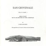 Fasc. 1. Lars Karlsson 2006, with appendices by Giovanni Colonna and Jenni Hjohlman. Area F East. Huts and houses on the Acropolis, Stockholm. ISSN 0081-993X. ISBN 9789170421723 (softcover: 196 pp.)
The excavations in Area F east were conducted 1960-1965. A trial trench, excavated by Bengt Malcus cut a part of House I in 1960. In 1961 Torgun Wieselgren extended the excavation to include all of House I with Court A. In 1962 Arne Furumurk excavated House II, a porticoed building with three rooms north of Court A. In 1963 Furumark and Stig Forsberg excavated House III with its western courtyard, Court D. In 1964 a metal roof was erected over the excavations. The work was finished in 1965. The excavations uncovered three houses: House I, measuring c. 11.3 x 5.8 m and containing two rooms, A and B. House II measures 12.3 x 5.1 m and contains three rooms, A, B and C. House III measures 15 x c. 6.35 m and contains two rooms, A and B. The building history can be divided into 4 periods: Period 1 (1400- 675 B.C.) shows the remains of 4 huts. A vary large amount of early impasto pottery was discovered. Period 2 (675-625 B.C.) is characterized by a very important and early rectangular hut with wattle-and-daub walls and a reed (canne) roof, very similar to the Tomba della Capanna in Cerveteri. Many formal drinking cups and jugs in a typical “Faliscanizing” type were discovered on the river-stone beds in Room B, a formal dining room. The building is one of the earliest in its kind known in Italy and remarkable owing to its preserved river-stone beds and well-dated fine pottery. Period 3 (c. 625-550) is the early Archaic phase with the three large Etruscan Houses, House I-III mentioned above, built with ashlar blocks and burnt roof tiles. The houses were probably destroyed in an earthquake around 550/530 B.C. Period 4 (550/530- c. 275 B.C) is the last period of this area. The houses were rebuilt on the old plan, several wells were back-filled. The majority of the finds date before the middle of the 4th century making it possible that the area was destroyed by the Romans in the campaigns of 388 B.C. The discovery of medieval pottery in the upper levels at the site is described by Jenni Hjohlman in Appendix 4. Appendix 3, by G. Colonna, is dedicated to an Etruscan inscription on a bucchero sherd with the name of Venelus Vefunas.
Reviews
American Journal of Archaeology 112:1, 2008 (Anthony Tuck)
L’Antiquité Classique 80, 2011, 602-603 (Marco Cavalieri)
Vol. 5. The Borgo
 Fasc. 1. Carl Nylander, Börje Blomé, Lars Karlsson, Angela Bizzarro, Giuseppe Tilia, Stefano Tilia & Alessandro Tilia 2013. Excavating an Etruscan quarter. Architecture and stratigraphy, Stockholm. ISSN 0081-993X. ISBN 9789170421808 (hardcover: 222 pp.)
Open access, use links below.
The Etruscan city of San Giovenale was excavated by the Swedish Institute of Classical Studies at Rome between 1956 and 1965. The ancient city plateau consists of two residential areas, the Acropolis and the Borgo, separated by a cut roadway. This publication deals only with the northwest corner of the Borgo (Borgo NW), which was excavated under the direction of Carl Nylander between 1961 and 1965. Here, in a “pocket” at the edge of the plateau, the Etruscans built a small metal working quarter, surrounded by a defensive terrace wall. Protected by the high tufa cliff a series of water cisterns and furnaces were installed. The excavations uncovered four major houses, Houses A, B, C and D, separated from each other by small drains and a Lane K. The houses, the drains and lanes are oriented west–east. A major well is located east and above House C. The most important settlement dates from the early Archaic period, in the late 7th century BC. The buildings were destroyed around 550/530 BC by a possible earthquake. The buildings were then rebuilt on a higher level and existed down to about 400 BC. Below the Archaic levels there are cuttings for huts and a wooden palisade.
The publication starts with an informative personal prolegomena by Carl Nylander in which the history of the excavations and the participating members are described. Chapter 1 is an introduction to the site and an analysis of the geology by Sheldon Judson. Chapter 2 gives the history of the work and Chapter 3 the settlement periods and the stratigraphy. Chapters 4 and 5 present the mainly rock-cut remains of pre-archaic structures. Chapter 6 attempts to describe the large work of levelling the area for the Archaic houses, called “The Great Fill Project”. The following chapters are archaeological and architectural descriptions of the walls and houses, starting from the north: House A (Ch. 7), Houses B and C (Ch. 8), Lane K (Ch. 9) and House D (Ch. 10). The possible earthquake as the destruction of the early Archaic settlement is discussed in Chapter Eleven. Chapters Twelve and Thirteen reports briefly on the very scattered traces of later developments. The book contains several appendices: a San Giovenale bibliography 1877‒2011, a catalogue of the walls at the site, an investigation of the mortar remains, a discussion on the roof-tiles and an explicatory text about the process of architectural documentation. Finally, the publication contains 43 plates with the very carefully drawn elevations and plans of the excavated buildings, originally produced by architect Börje Blomé, later digitalized and completed by Giuseppe, Stefano and Alessandro Tilia as well as by Angela Bizzarro.
Contents
Contents
Download PDF - Size: 160.87 KB - Downloads: 652 (since 2023)
Carl Nylander, Acknowledgements
Download PDF - Size: 154.66 KB - Downloads: 206 (since 2023)
Carl Nylander, Ringraziamenti
Download PDF - Size: 154.69 KB - Downloads: 237 (since 2023)
Lars Karlsson, Preface
Download PDF - Size: 180.80 KB - Downloads: 208 (since 2023)
List of illustrations
Download PDF - Size: 170.92 KB - Downloads: 224 (since 2023)
Bibliography
Download PDF - Size: 199.41 KB - Downloads: 211 (since 2023)
Carl Nylander, Personal prolegomena
Download PDF - Size: 632.99 KB - Downloads: 230 (since 2023)
Chapter 1. Introduction to the geography and geology of San Giovenale
Download PDF - Size: 849.57 KB - Downloads: 238 (since 2023)
Chapter 2. History of the Borgo excavations
Download PDF - Size: 645.44 KB - Downloads: 223 (since 2023)
Chapter 3. Excavation areas, periods and stratigraphy, by Lars Karlsson
Download PDF - Size: 626.75 KB - Downloads: 237 (since 2023)
Chapter 4. Pre-House Period I
Download PDF - Size: 523.48 KB - Downloads: 225 (since 2023)
Chapter 5. Pre-House Period II
Download PDF - Size: 330.78 KB - Downloads: 205 (since 2023)
Chapter 6. The Great Fill Project
Download PDF - Size: 836.31 KB - Downloads: 204 (since 2023)
Chapter 7. The northern Area A. Buildings and stratigraphy of periods 1 & 2
Download PDF - Size: 1.20 MB - Downloads: 216 (since 2023)
Chapter 8. The central Area B/C/I/R
Download PDF - Size: 1.56 MB - Downloads: 226 (since 2023)
Chapter 9. Lane K
Download PDF - Size: 233.13 KB - Downloads: 217 (since 2023)
Chapter 10. The southern Area D/E/F/G/H
Download PDF - Size: 280.80 KB - Downloads: 209 (since 2023)
Chapter 11. An earthquake at San Giovenale in the 6th century BC (?)
Download PDF - Size: 324.00 KB - Downloads: 215 (since 2023)
Chapter 12. Period 3—after the earthquake
Download PDF - Size: 373.91 KB - Downloads: 208 (since 2023)
Chapter 13. Periods 4 & 5—later developments
Download PDF - Size: 294.83 KB - Downloads: 205 (since 2023)
Chapter 14. Summary, by Lars Karlsson
Download PDF - Size: 165.75 KB - Downloads: 194 (since 2023)
Appendix 1: San Giovenale bibliography 1877–2011, by Kerstin Bellerba & Brita Alroth
Download PDF - Size: 207.83 KB - Downloads: 217 (since 2023)
Appendix 2: Osservazioni sulle strutture murarie, by Barbara Belelli Marchesini
Download PDF - Size: 189.71 KB - Downloads: 223 (since 2023)
Appendix 3: An investigation into ancient mortars, by Marie Klingspor Rotstein & Daniel Kwiatkowski
Download PDF - Size: 658.87 KB - Downloads: 219 (since 2023)
Appendix 4: The roof-tiles, by Örjan Wikander
Download PDF - Size: 255.16 KB - Downloads: 207 (since 2023)
Appendix 5: Documentation of architectural remains, by Angela Bizzarro
Download PDF - Size: 364.51 KB - Downloads: 232 (since 2023)
Plates
Download PDF - Size: 1.30 MB - Downloads: 193 (since 2023)
Reviews
Bryn Mawr Classical Review 2014.07.18 (Flavia Morandini)
Gnomon 88:6, 2016, 535-539 (Jon Albers)
Journal of Roman Archaeology 27, 2014, 504-509 (Ingrid Edlund-Berry)
L’Antiquité Classique 84, 2016, 509-510 (Jean-Christophe Caestecker)
Revue Archèologique, Nouvelle Série, Fasc. 1, 2015, 236-237 (Jean-René Jannot)
 Fasc. 2. Ingrid Pohl 2009. The Etruscan habitation quarter on the North-West slope. Stratification and materials, Stockholm. ISSN 0081-993X. ISBN 9789170421761 (softcover: 114 pp.)
During 1961–1963 and 1965, excavations were carried out on the so-called Borgo as part of the large-scale archaeological investigations of San Giovenale which took place in 1956–1965. A large habitation complex consisting of houses, courtyards, lanes and wells was uncovered. The architectural remains and their stratigraphy will be presented in Part I of the publication. In this part (Part 2) the stratigraphy and the material found in the excavations are presented.
The stratigraphy of the area is presented both in the chapter ‘Stratigraph’, which provides an overview of the different building periods, and in the ‘Catalogue’ in connection with the presentation of the finds from the individual buildings and other architectural features. The Catalogue also includes brief accounts of the excavation history.
The large find material is presented in the ‘Catalogue’. The major part consists of pottery, but smaller categories of finds, such as cooking stands, spindle whorls, loom-weights etc. are also included. In the ‘General discussion’, all categories of ceramics and other finds are discussed. The systematic survey of the pottery, which includes not only the fine imported ceramic, the Etrusco-Corinthian and the Bucchero, but also the simple household and kitchen ware, considerably contributes to our knowledge of the development of different types of ceramics, especially of the common ‘everyday’ pottery which so far has often been more or less neglected. Finally, the development of the ceramics is summarized period by period in the ‘Conclusion’.
Reviews
Anzeiger für die Altertumswissenschaft 64, 2011, 202-207 (M. Praxmarer)
L’Antiquité Classique 80, 2011, 603-604 (Marco Cavalieri & Jean-Christophe Caestecker)
Bryn Mawr Classical Review 2014.07.18 (Flavia Morandini)
Revue Archéologique 1, 2011, 121-122 (Jean-René Jannot)
Vol. 6. Excavations and finds. The bridge on the Pietrisco. Vignale. The castle and the chapel.
Fasc. 1 not yet published.
 Fasc. 2–3. Yvonne Backe Forsberg & Richard Holmgren 2024. What’s beyond the Etruscan bridge? Analysis and dating of the Vignale plateau, Stockholm. ISSN 0081-993X. ISBN 9789170421884 (hardcover: 345 pp.) https://doi.org/10.30549/actarom-4-26-6-2-3
Open access, use links below.
The Etruscan site of San Giovenale has been excavated periodically since 1956. From the beginning the main focus has been the question of settlement remains. However, a fundamental area within the site had still not undergone the inquiry necessary for a complete understanding of the site as a whole. The Vignale plateau, connected to the main site by an Etruscan bridge, was surveyed and partly excavated in 1959–1960, but not published. The Vignale Archaeological Project (VAP) began new investigations in 2006 that aimed to answer the question of “What’s beyond the Etruscan bridge?” This publication focuses on the initial investigations of 1959–1960, augmented by new ground- and aerial remote sensing surveys.
The current volume is divided in six chapters. Through an introduction, and geological/topographic and historical/archaeological settings (Chapters 1–3), the reader achieves a general understanding of Vignale within a larger framework. The main archaeological studies of various features on the plateau, their function and dating are covered in Chapter 4, where Vignale from the Final Bronze Age to medieval times is approached with an emphasis on the Etruscan periods. The study of the latter investigates the connection to Vignale’s sister plateau (the Acropolis area), and the plateaus’ connection to the surrounding landscape. An intrinsic aspect of Vignale is the association with wine over time. Chapter 5 therefore elaborates on wild and domesticated vines with emphasis on production, ritual, and material remains, concluding with a summary and synthesis in Chapter 6. Two extensive appendices follow, one detailing the material remains and data connected to the southern Bridge Complex, and the other a treatise on the Etruscan awareness of their local mineral salt, alunite.
Contents
Front matter
https://doi.org/10.30549/actarom-4-26-6-2-3-01
Download PDF - Size: 255.01 KB - Downloads: 307 (since 2024)
Contents
https://doi.org/10.30549/actarom-4-26-6-2-3-02
Download PDF - Size: 202.39 KB - Downloads: 294 (since 2024)
Acknowledgements
https://doi.org/10.30549/actarom-4-26-6-2-3-03
Download PDF - Size: 273.48 KB - Downloads: 304 (since 2024)
List of abbreviations
https://doi.org/10.30549/actarom-4-26-6-2-3-04
Download PDF - Size: 154.52 KB - Downloads: 277 (since 2024)
List of illustrations
https://doi.org/10.30549/actarom-4-26-6-2-3-05
Download PDF - Size: 277.63 KB - Downloads: 302 (since 2024)
Chapter 1. Gemeral introduction. “Make bricks without straw”
https://doi.org/10.30549/actarom-4-26-6-2-3-06
Download PDF - Size: 265.12 KB - Downloads: 262 (since 2024)
Chapter 2. The Vignale plateau. Geological, topographic, and historical setting
https://doi.org/10.30549/actarom-4-26-6-2-3-07
Download PDF - Size: 1.05 MB - Downloads: 292 (since 2024)
Chapter 3. Archaeological studies on Vignale
https://doi.org/10.30549/actarom-4-26-6-2-3-08
Download PDF - Size: 536.14 KB - Downloads: 311 (since 2024)
Chapter 4. Remnants of the past. The structures of Vignale
https://doi.org/10.30549/actarom-4-26-6-2-3-09
Download PDF - Size: 7.02 MB - Downloads: 686 (since 2024)
Chapter 5. Vignale and the wine connection. Economic and religious prerequisities from Etruscan to medieval periods
https://doi.org/10.30549/actarom-4-26-6-2-3-10
Download PDF - Size: 1.80 MB - Downloads: 417 (since 2024)
Chaper 6. Final synthesis and chronological overview
https://doi.org/10.30549/actarom-4-26-6-2-3-11
Download PDF - Size: 248.72 KB - Downloads: 248 (since 2024)
Appendix 1. Catalogue and artefact analysis from the trenches on the southern Bridge Complex
https://doi.org/10.30549/actarom-4-26-6-2-3-12
Download PDF - Size: 1.66 MB - Downloads: 288 (since 2024)
Appendix 2. The Etruscans and the question of alunite
https://doi.org/10.30549/actarom-4-26-6-2-3-13
Download PDF - Size: 630.14 KB - Downloads: 308 (since 2024)
Appendix 3. Conservation of a Hellenistic altar, by Agneta Freccero
https://doi.org/10.30549/actarom-4-26-6-2-3-14
Download PDF - Size: 291.54 KB - Downloads: 266 (since 2024)
References
https://doi.org/10.30549/actarom-4-26-6-2-3-15
Download PDF - Size: 365.15 KB - Downloads: 394 (since 2024)
Concordance
https://doi.org/10.30549/actarom-4-26-6-2-3-16
Download PDF - Size: 177.23 KB - Downloads: 238 (since 2024)
 Fasc. 4–5. Bengt Thordeman & Bertil Hallert 1967. The medieval castle of San Giovenale. Terrestial photogrammetric survey of the San Giovenale castle, Stockholm. (softcover: 84 + 10 pp.)
Excerpt, fasc. 4, on the medieval castle, p. 4:
The Area of the Swedish archaeological excavation of the deserted Etruscan settlement of San Giovenale has received its name from the ruin of the medieval castle dominating the site. The castle, in its turn, was probably named after the small church whose remains lie within the castle precincts and which in its earliest part is older than the castle. The San Giovenale, Sanctus Juvenalis, to whom the church is dedicated, became bishop in 369 in the not far distant Narni, where he died in 376 and where his tomb is still preserved, having been incorporated with the cathedral in the twelfth century. In 878 the margrave Adalberto had the saint’s remains removed to Lucca, but he was prevailed upon to return them two years later. It was then that they were probably laid in a still extant sarcophagus (Fig. 1), and the oratory at the tomb was then also embellished with a fine mosaic representing Christin Majesty (Fig. 2). This surrounded by fresco paintings, some of which depict miracles from the legend of the saint. The paintings were presumably done for the consecration of the cathedral in 1145. In the legend there are no signs that the saint was personally associated with the site of the castle of San Giovenale.
The castle, mainly triangular in plan, is situated on the eastern part of the slightly inclined, crescent-shaped plateau, which is about 400 m long and bounded by deep ravines (Fig. 3). The major partof the prehistoric and Etruscan settlements were located west of the castle. The purpose of the castle, as well as of its Etruscan predecessor on the same ground, was to block the only passable way up to the plateau. Here it may already be said – as will later be proved – that evidently the castle was never completed.
Excerpt, fasc. 5, on the photogrammetric survey, p. 3:
The geodetic control net-work was planned to serve the survey of the castle with the aid of terrestrial photogrammetry. The requirements of this survey and the consequences for their planning of the geodetic control points in planimetry and elevation have been discussed in vol. I, fasc. 3.
In order to obtain sufficient accuracy in the terrestrial photometric plotting the control points had to be considerably extended and particular attention had to be paid to the terrestrial photography.
Reviews
Classical World 62:2, 1968, 53 (Edward L. Ochsenschlager)

No Comments
Comments are closed.